
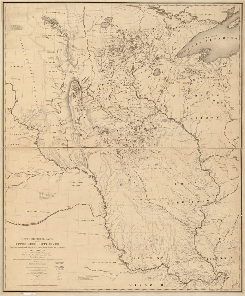
Wabasha, where I currently live, is the oldest town in Minnesota, inhabited since 1826. An 1843 map, by Nicollet and Fremont (names you’ll see a lot of in Minneapolis) lists it as the trading post of ‘Roques’ for the half-Indian (mother was the sister of chief Wapasha, for whom the town is named), half-French leader of it. The 1874 Atlas of the State of Minnesota has a history of the region, as well as a few other sources, generally agreeing that the area was inhabited and confirmed in the 1830 treaty, ‘The 2nd Treat of Prairie du Chien’. Generally the area of Wabasha appears to been populated by a people of mixed native and French ancestry for some time before a major wave of European settlement.

The 1820’s were the first days of Minneapolis as well, with the Mendota trading post and Fort Snelling active in the region, although almost everything west of the Mississippi River was officially Indian land and not settled until Indian treaties ‘opened up’ the land around 1850 (see the US-Dakota War of 1862). The local Native Americans were a Dakota branch of the Sioux, who were apparently rivals with the Chippewa (who were close by, the river coming in from Wisconsin near Wabasha is called the Chippewa River after them). My great-great-great-great-uncle George Catlin (I’m guessing on the number of ‘greats’ there, my relatives could give the exact number) is worth mentioning as he traveled among the Native Americans and is paintings are one of the best surviving sources of color portrayals of their dress and lifestyle, and are commonly seen in histories of this time.
There were a large number of Native American burials, Indian mounds as they are often called right in the town of Dumfries and along the river by the high school. Most of these have been destroyed. I haven’t been able to find any exactly, but I imagine a few can be found if looked for.
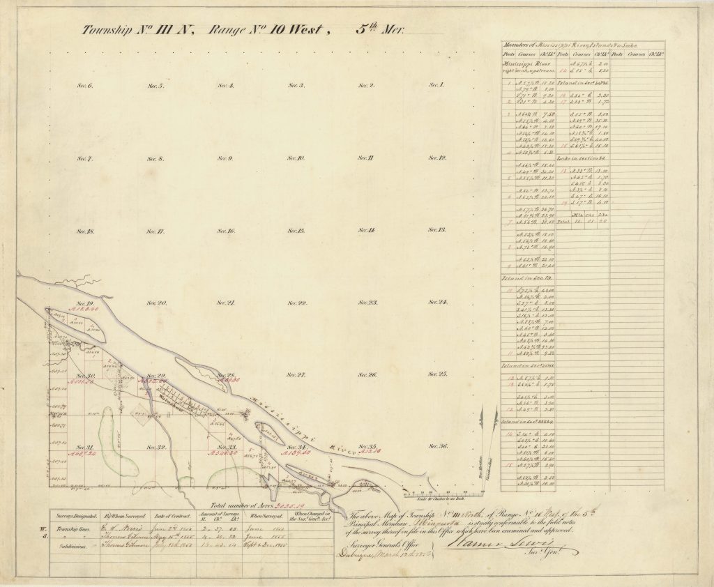
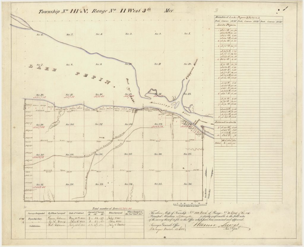
The first somewhat-detailed maps of the Wabasha area come from the 1850’s in the plat survey maps, by which point Wabashaw, Reed’s Landing, and Lake City all existed. Perhaps the most interesting fact for me from the survey maps is that they draw large forests (Red Oak, Linden, hazel thickets in nearby areas) and they have no forests for anywhere near the farm. This confirms that this was originally mostly grassland. Another interesting fact is the County Road 10 and 61 didn’t exist, okay, no surprise there, but a road/trail did exist from Reed’s Landing and it instead went up the coulee near Camp Lacupolis, then followed loosely where County 10 is today. There is no immediate evidence of that old road in the coulee from what I can tell from the modern road. This trail become the Wabasha-Mendota Military Road which was a way to get around the frozen Lake Pepin in winter and spring.
Wabasha and Reed’s Landing both were known to be seasonal boomtowns in spring when the riverboats were stopped there, waiting for the ice to melt off of Lake Pepin. People who didn’t want to wait could take the old military road. The Zumbro River used to run into the city of Wabasha itself, this was the junction of those rivers, but in the 1970’s it was straightened to prevent flooding, leaving the lakes that are present there still. Wabasha also used to have a large grain mill that dominated the river front. Wabasha’s peak population was in the 1910 census, and it has never recovered to that level (although it’s not too much lower, and has been remarkably consistent in population in the hundred years since then, unlike many small towns which either grew or disappeared).
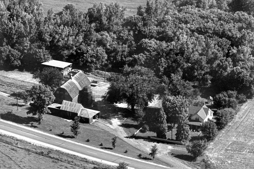
The featured aerial image of this blog post is from 1968 which is the earliest photo we have of the Oenning farm. This started in the post-Civil War era and grew. It is fascinating thing to stare at, both at how much is the same and how much has changed. What I cannot tell from the photo is how deep the ravine was at the time. It appears to be there, but not nearly as deep.
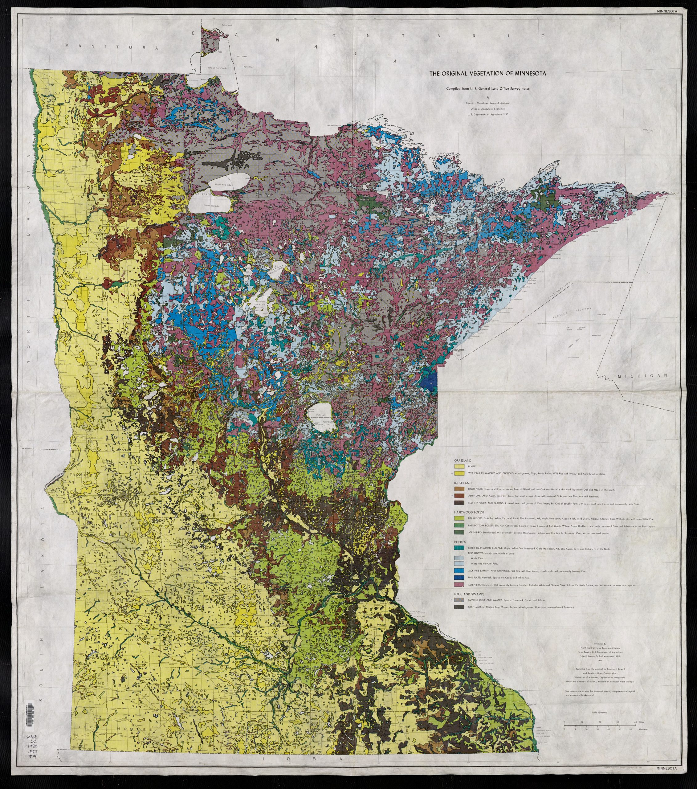
There are a number of resources on “presettlement vegetation” such as the U of M all of which are based on the original survey maps as shown below. They tend to show a mix of oak savannah, hardwood forest, prairie, wet prairie, river bottoms forest, and the Kellogg-Weaver dunes, really the Wabasha area had quite the mix of landscapes due to the mixture of moist bottom land, steep limestone slopes, and then flatter areas (presumably burnt by the frequent prairie fires). There seems to have been some isolated white pine too, but not as much as the Chippewa River. The Chippewa River (and the Red Cedar) held roughly one-sixth of all white pine in the U.S. west of the Appalachians, and that coming down the Chippewa River largely looks to have gotten processed in the area around Wabasha.
Colin Catlin, 2023. Updated 2026.