
Once upon a time, there was no valley, no ravine, no house, and no driveway.
Between 30,000 and 15,000 years ago, glaciers reached their maximum extent covering much of North America. As the glaciers melted, they formed a massive lake around 13,000 years ago called Lake Agassiz. Over roughly the next three thousand years this lake constantly evolved. At one point, the amount of water flowing out of it into the Arctic Ocean is believed to have caused a temporary cooling of the entire Earth, and brief advance again of the glacier sheets.
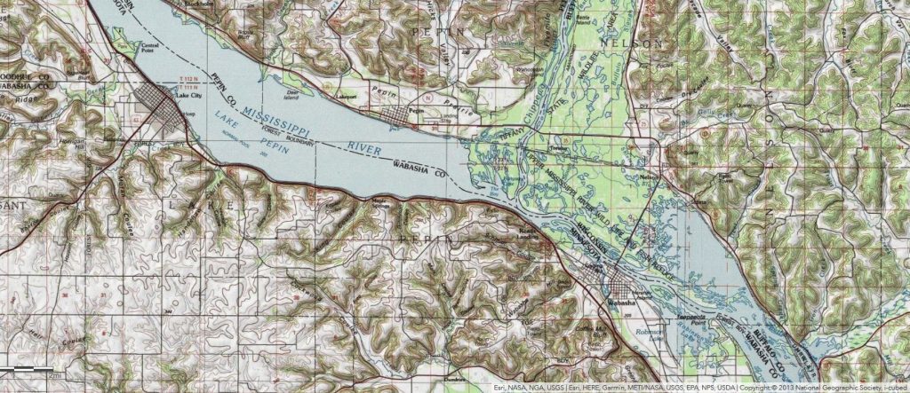
The outflow from Lake Agassiz – it shifted over the centuries – was sometimes into the River Warren – which later evolved into the Minnesota and Mississippi Rivers. This massive amount of water created the present river channel’s wide valley through which the Mississippi flows in southern Minnesota. With the melting glaciers gone, and Lake Agassiz with them, waterflow decreased. 10,600 years before present (BP), silt from the Chippewa River partially dammed the Mississippi River, spreading over 300 years until it had expanded as far as present day Lake City, and then continued on expanding north.
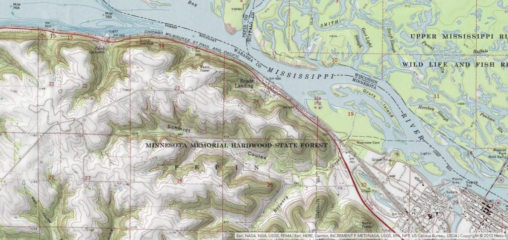
Our own little valley, flowing into the Mississippi River near Wabasha directly across from the Chippewa River, probably dates from sometime during this 13,000 to 10,000 year period when the Agassiz lake was draining down the River Warren and digging the massive bluffs of this region. This was around the time the boreal spruce forests left the region – about 11,500 years BP to be replaced by pine forests, and then 9,000 years ago, to be replaced by prairie. The prairie in turn gradually transitioned to birch and oak savannas around 4,500 years ago. It’s now a mix of agricultural land and forests. The forests in question are extremely diverse for a small area: containing walnut, hickory, oak, maple, willow, ironwood, ash, elm, cottonwood, and more. On rougher parts of the slope, ash, spruce, and cedar trees still hold on. All of the oldest trees have been removed by loggers…
Source: Formation and early history of Lakes Pepin and St. Croix of the upper Mississippi River
The size of the valley was determined by the amount of rain water it had to drain that wasn’t absorbed by vegetation. For the last 5,000 years, perhaps much longer, the valley has likely retained most of its present size. However, come the late 1800’s, settlers came and cleared the land for agriculture, and so begins the story of the ravine – a valley inside the valley.
Our retired neighbor, Steve, who grew up in the valley, reports that his father remembered a time when the ravine could be jumped across, being no more than a seasonal stream. This would have been the early 1900’s. Unfortunately, these farmers did not seem to know much about erosion, and so by the present day, the ravine is, at it’s narrowest, at least 20 meters across, and usually more like 50 meters across.
The early farmers did try to battle the ravine’s growth – dozens of ancient cars lying buried in the mud tell the story of one such effort. Culverts are buried in some places to control water flow, and a large berm is built just north of our farm across one branch of the ravine. But there was no clear, coordinated plan to slow the ravine’s growth. Ultimately, economic changes stopped its growth, as most of the valley is no longer used for intensive agriculture and has forested over.

Only in spring, during the melting of winter snows, does the ravine erode particularly much. For the rest of the year, even during massive rains like that experienced for the last 36 hours, the ravine is largely untroubled, wide enough to slow the water as much as needed. The existing problem with the ravine is that it is forested, and most of the soil does not have resilient root systems to hold it in as a result. Largely this results from a lack of concern, as well as the myth that trees do a good job of holding in soil. However, trees’ shade means large areas of ground go covered by poorly rooted plants, if any. Deep rooted prairie-savana would be far better, as would a check dam and some wetlands to absorb some water and slow the velocity of the remaining.
Now, in our lives, another major erosion story has begun. The building of the new house, it’s driveway, and the relationship to the other out buildings have concentrated a large area of water down a narrow driveway. The real problem, however, is water velocity. The slope from road down to culverts into the ravine is quite steep, funneled into a narrow area, and without any impediments, across largely impervious concrete/gravel/sod, the water rapidly picks up speed.
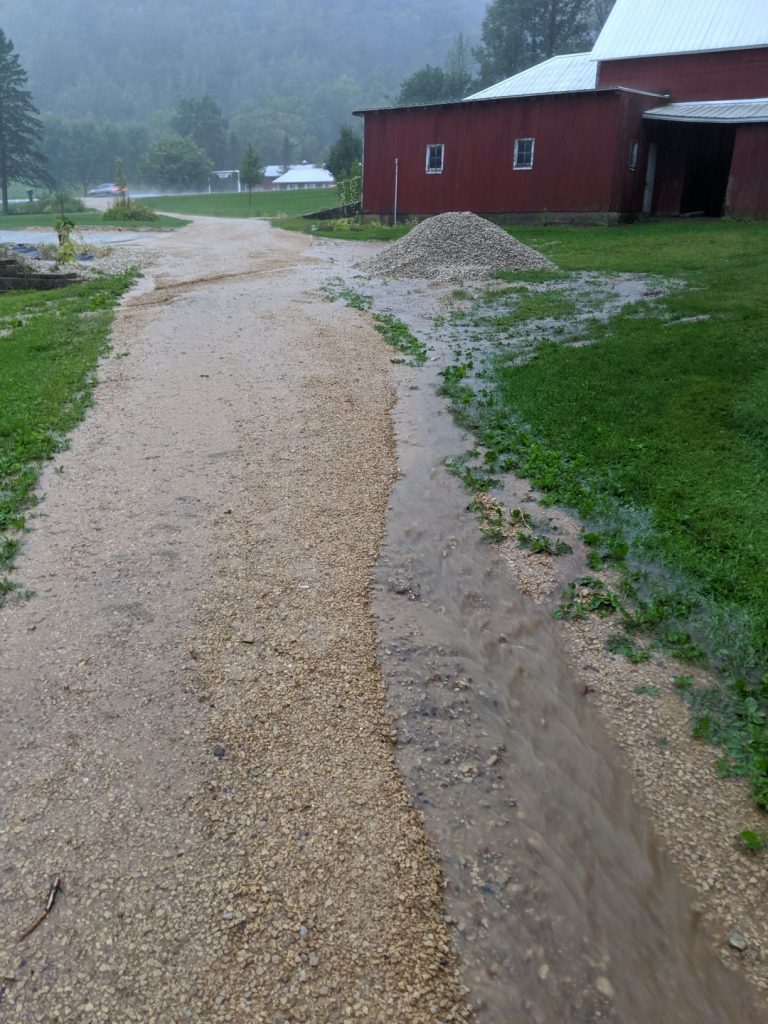
Water carries away gravel on the right side of the driveway. Reasons for speed: high speed runoff from rooves crosses largely impermeable gravel/sod while traveling uninterrupted down a slope. Partially visible in the upper left, a rain garden keeps the left side of the driveway under control (which actually catches water from the from the upper right side as well, which crosses).
Why is water speed a problem? Because faster water can carry a lot more (and larger) sediment, and a lot more sediment means a lot more erosion. More speed = no more gravel driveway. Paving the driveway (only part near the house is concrete right now) seems like the obvious solution, but would actually make problems worse everywhere else, as the velocity of water across pavement is even faster.
I’ve already built a pond and a rain garden to help. Both have helped, saving the middle section and left side of the driveway completely from erosion, but they are only part of the plan necessary to fully stop erosion. The pond is only mildly successful, as it filled up surprisingly quickly. The rain garden is a major success, catching large amounts of water and absorbing it quickly. Even in a crazy major storm where it overflows, it still adds major value: the input water is flowing in very rapid, but water leaves at a much gentler pace.
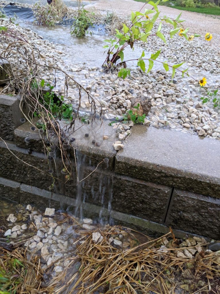
A number of minor fixes are needed, but the one outstanding problem is the right side of the driveway, seen a few pictures above. The difficultly is that the logical place to stop the water is right in front of the door to the barn – and no one particularly wants to build a bridge into the barn. Maybe I could sell it as a defensive moat, complete with drawbridge? While diverting the water under the driveway in a pipe would save the driveway from erosion, it would not slow or absorb the water at all, leading to problems further down that would begin to erode under the driveway.
What is amusing is that the water is slowed, just a bit further down, by a series of massive check dams.
By which I mean: planters for dad’s hops.
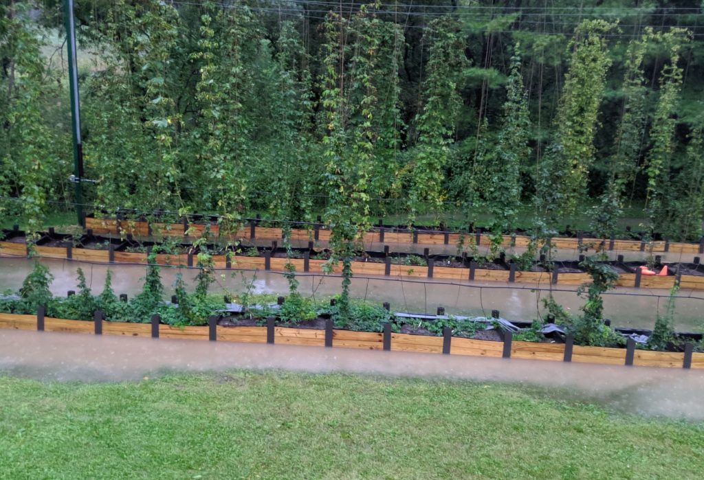
The hops area (just downhill from the driveway seen above, with the ravine just beyond) is completely flooded after heavy rain, but within a few hours the water has slowly been absorbed or traveled down.
http://m.startribune.com/in-southeast-minnesota-swollen-river-threatens-to-reclaim-cropland/563386792/